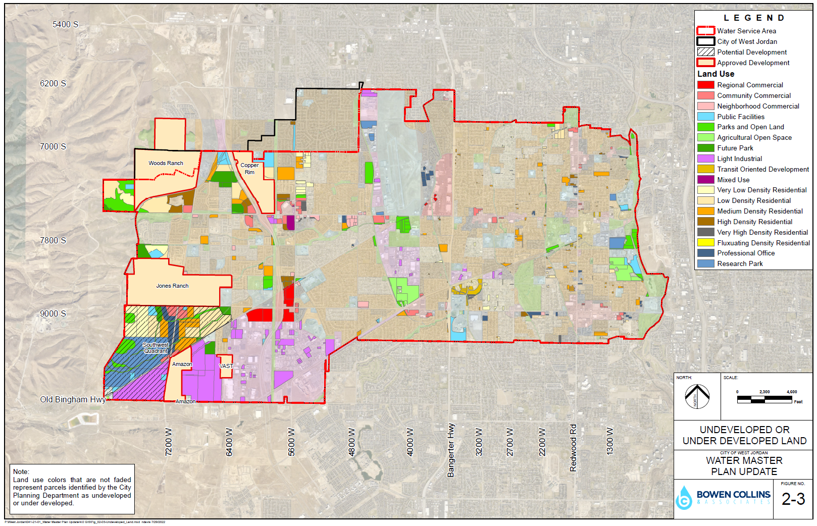
While the rates of growth from the WFRC are useful for projecting how fast growth will occur, it is less useful for predicting final densities and buildout growth for the City. This is especially true for the City's west side, where larger parcels of land are still available to be developed. The City's planning department has developed a land use plan which, when combined with historic water use, can be used to project the buildout water demand.
Figure 2-3 shows the undeveloped or underdeveloped areas in the City as identified by the planning department. The figure also details the planned land use and developments that the City is aware of and has either approved or is under review.
