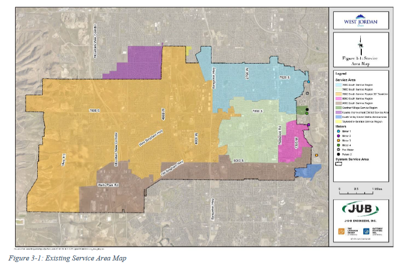
The City's collection system service area (Figure 3-1) is approximately 7.5 square miles and services 24,275 connections, of which there are 22,714 residential, and 1,561 non-residential connections.
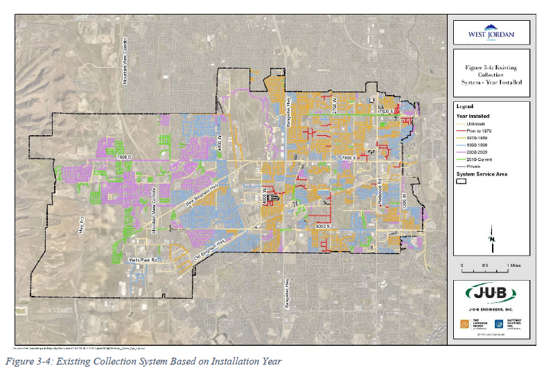
The collection system contains 365 miles of pipeline ranging in diameter from 8 inches to 36 inches, 7,039 manholes, and three private pump stations (Figure 3-2). Over the years the existing collection system has been constructed of various pipe materials that were typically used at the time of construction. The following table (Table 3-1) and figures (Figure 3-3 and Figure 3-4) summarize and illustrate the pipe materials and installation year of pipe within the collection system. A large-scale figure of each of these maps can found be in Appendix A.
Pipe Material | Installation Year | ||
CIPP | 7,182 ft | Prior to 1970 | 52,636 ft |
Clay | 207,465 ft | 1970-1989 | 457,763 ft |
Concrete | 387,300 ft | 1990-1999 | 386,473 ft |
HDPE | 16,360 ft | 2000-2009 | 314,362 ft |
PVC | 939,176 ft | 2010-Current | 150,764 ft |
Slip Lined | 3,323 ft | ||
It should be noted that the full 365 miles of pipeline is not included in the summary data above. Within the reference data that was used to calculate the lengths above, various segments of pipe were not labeled with a material or date of installation. Therefore, additional analysis should be completed by the City to determine the exact numbers to supplement the information in the table above.
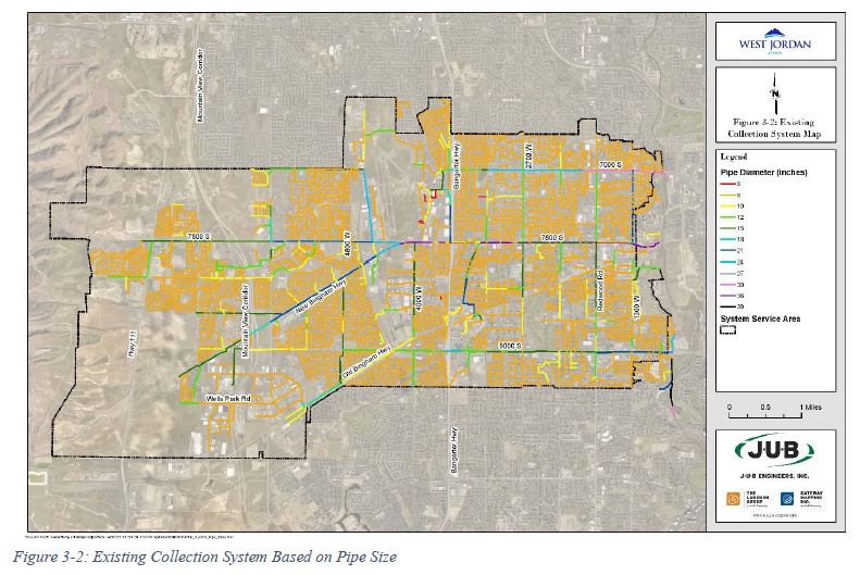
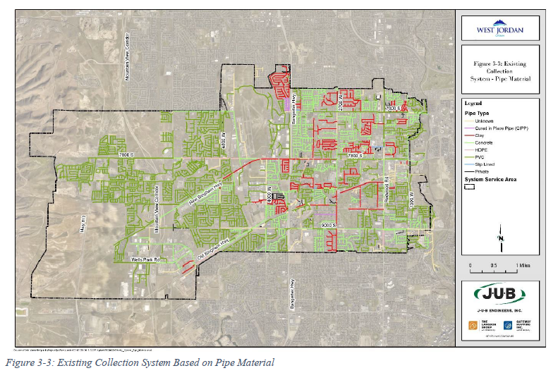
The collection system conveys flow from the west side of the City at the base of the Oquirrh Mountains by gravity to the eastern City boundary on the west side of the Jordan River. The pipelines in the original areas of the City are constructed primarily of vitrified clay pipe (VCP) and some concrete pipe. Pipelines in roads and subdivisions built after the late 1970s are constructed primarily of plastic pipe. The primary trunk sewer, which transports wastewater to the SVWRF at 7495 South 1300 West, is a 48-inch diameter pipeline running south to north on the west side of the Jordan River bottoms. City trunk lines with discharge meters at the primary trunk sewer are located at 7000 South, 7800 South, 8050 South, and 9000 South. Other metering locations are shown on the Service Area Map in Appendix A.