
Land use plans establish the long range direction for communities. Map 9 Preferred Land Use in the map section shows the ideal form Lewisville should take over the next 20 years. This plan reflects the desires of citizens to preserve the town’s rural residential nature as the predominant land use feature of the community. Retail and office development are strongly favored for the current designated commercial districts.
This plan was prepared in the context of a changing environment. Several key policies and future plans were considered during the development of these guidelines. The Northern Beltway and subsequent potential development around the anticipated schools at Robinhood Road and Lewisville-Vienna Road, sewer extensions, stormwater/impervious surface regulations, watershed regulations, growth management, existing land use patterns and the potential for annexation were all important factors in developing the future land use plan for Lewisville.
The recommendations shown on Map 9 Preferred Land Use are intended to help the town, property owners and residents make zoning and development decisions that are in the best interest of the community. Other policies created by the Town Council should be consistent with this plan.
Lewisville existed as a rural community long before the 1991 incorporation as a small town, and the land use patterns seen today still reflect those early provincial roots. As the Map 8 Existing Land Use shows, residential uses are the predominant feature in the landscape. Small scale commercial and institutional uses are and should be clustered in the town’s designated commercial districts.
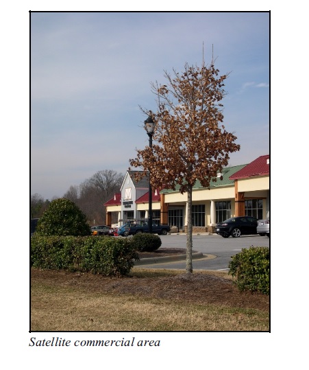
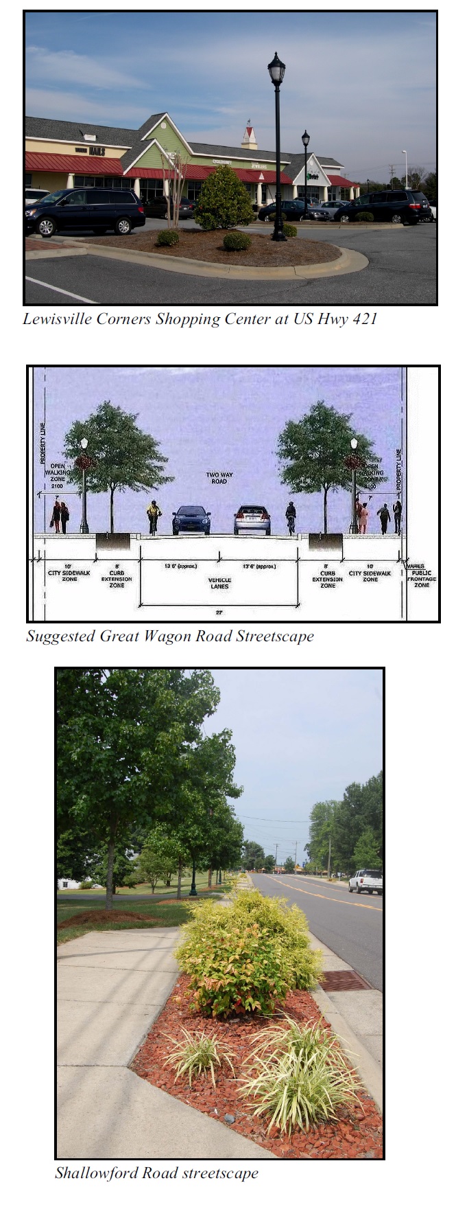
Satellite commercial areas will continue to be located at US 421/Lewisville-Clemmons Road interchange and the Vienna Business District. A small pocket of industrial uses is located behind the Roller Mill along Jennings Road. There are other commercial locations in the town that were existing prior to incorporation that the town does not wish to further develop or expand.
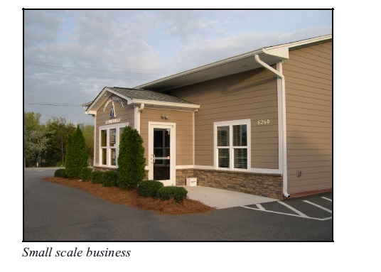
Home-based, nonresidential land uses dot Lewisville’s residential landscape. These “home-grown” uses pre- dated incorporation and exemplify Lewisville’s rural heritage. The community acknowledges and respects the unique diversity these business services provide and wishes to protect their continued viability.
There is a common desire to have Lewisville remain a residential community. This plan goes beyond the 1992 land use recommendations and envisions diversifying Lewisville’s residential land use patterns in several different ways. These include the possibility of increasing density in certain areas, encouraging clustering options, and expanding multifamily districts as sewer availability increases. (See Map 8 Existing Land Use, Map 9 Preferred Land Use and Map 7 Sewer Utilities.)
Areas generally outside the watershed, where sewer exists or can be extended, and where existing development patterns based on current zoning already allow slightly higher density development are recommended for more intense development than indicated in the previous Plan. All lands within the Lewisville Rural Overlay (LRO) area shall be eligible to receive both water and/or sewer services if the owner chooses to be annexed into the Town of Lewisville.
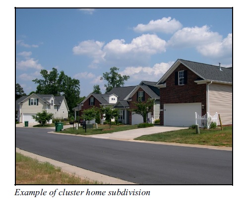
Clustering homes using enhanced Planned Residential Development (PRD) standards can be a useful method for preserving open space and gaining additional amenities for residents. (See Chapter 3 Natural Environment and Housing and Neighborhoods in this chapter for more on clustering.) Residents have indicated an interest in seeing clustered housing located near the downtown as a way of increasing activity in the area while also preserving the open space character.
Housing and Neighborhoods
In 1996 there were 3,147 households in Lewisville. With the annexation of the northern area, the number of households increased from 3,147 to 4,992 which increased the population to more than 12,500.
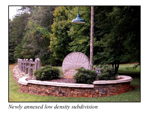
This newly annexed area consisted of a mix of larger working farms and lower density residential subdivisions approved under county zoning subdivision regulations. These regulations required a minimum lot size of 20,000 square feet for homes with septic tanks. There are also several established mobile home parks located within the area along Robinhood Road and individual mobile homes on scattered sites throughout the planning area.
The Winston-Salem/Forsyth County Schools have purchased more than 72 acres along Robinhood Road to construct potential new schools. As proposed, a new sewer line is to be built having additional capacity that will allow undeveloped land(s) immediately around the school site to be developed to densities not permitted by conventional septic tanks. Existing residences may benefit also by the location of this line allowing property owners to convert from their residential septic systems to public sewer.
The Preferred Land Use Plan (see Map 9 Preferred Land Use) recommends increasing residential density around the downtown by encouraging clustering design. The plan also recommends maintaining the large lot patterns for the remaining portions of the community where existing development patterns are firmly established and where sewer may not be practical or attainable. Future plans to sewer other basins by CCUC or the town could, however, significantly change the overall residential density and lotting patterns.
The character of Lewisville depends greatly on its open, pastoral nature. To control sprawl and preserve open space and environmentally significant land, this plan encourages the clustering of housing (PRDs) and sets mandatory open space requirements within subdivisions. (See Figures 1 & Figure 2.) These policies, combined with landscaping standards found in the UDO, will help ensure that the character and identity of Lewisville are not compromised.
The clustering of housing units will also help provide for a variety of housing types, making Lewisville’s housing stock more available and more affordable to a variety of residents.
Commercial Districts
Recognizing the opportunity for increasing the intensity of development within the downtown, this Plan recommends that a mix of office, retail and residential uses be established.
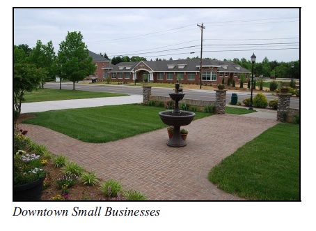
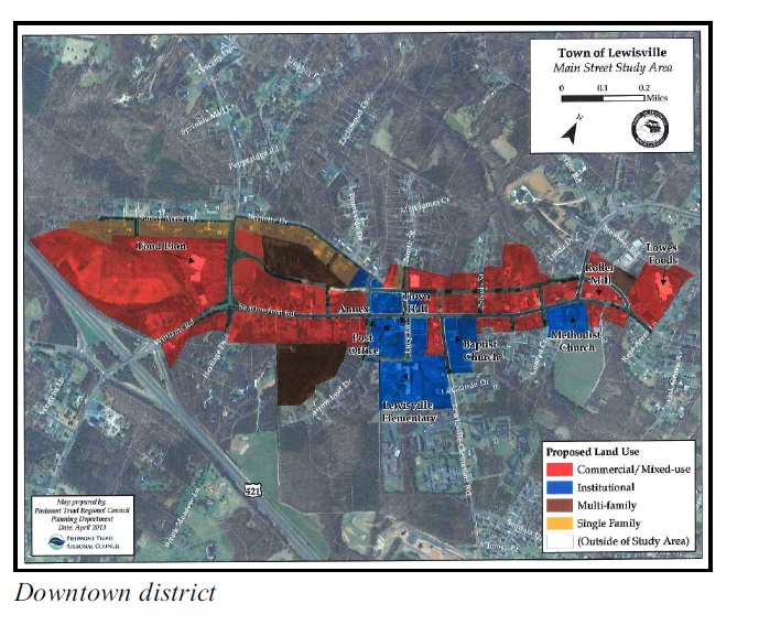
Since the first Comprehensive Plan was adopted in 1992, many projects have been undertaken to create an attractive, traditional downtown commercial area in keeping with the vision of Lewisville citizens. The downtown is now formally defined as the stretch of road between Williams and Shallowford Roads from US 421 on the west and Lowes Foods Drive to the east which encompasses approximately 177 acres. This area is considered the focal point or heart of Lewisville.
Lewisville’s desire for an attractive downtown led the town to adopt additional regulations for governing new development. These guidelines are intended to enhance and protect Lewisville’s unique, small town character. (Refer to Map 8 Existing Land Use.) These standards provide guidance on the style and character of new development and help to assure an aesthetically pleasing environment.
A prior critique of these standards reaffirmed the community’s position that aesthetically pleasing design is critical to creating a successful downtown. The ideals of the community are reflected in the objectives of the Overlay District standards. (See the Lewisville Unified Development Ordinances.) The group stressed that site design, compatible scale, landscaping and other amenities are as important as the type of land use. Residents do not want strip development in downtown Lewisville. This plan reinforces the commitment of this community for consistent design by recommending additional standards for public space in downtown and that downtown standards be applied to other commercial areas in Lewisville.
This mixed-use development pattern is also proposed for the Vienna Business District.
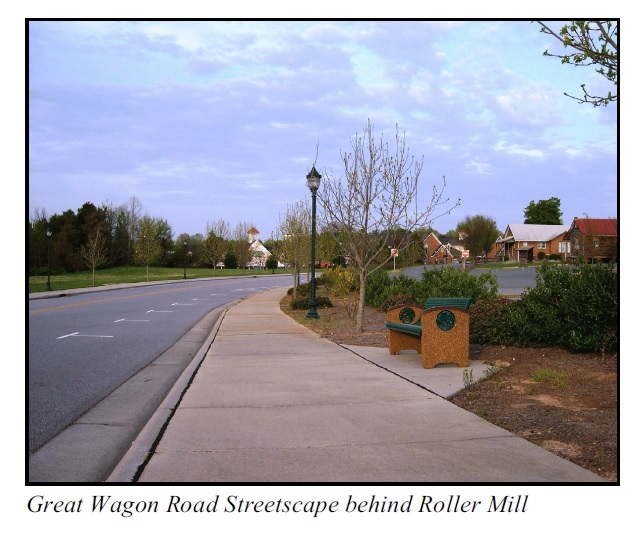
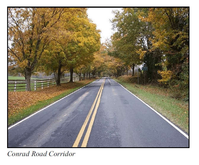
The Lewisville 2015 Plan, originally prepared in 1997, and renamed the Parallel Road Plan in 2005, set forth a vision for improving Shallowford Road and developing a new parallel street to Shallowford Road. The new road, named the Great Wagon Road, and the proposed cross street extensions were proposed to be developed in phases as warranted by increased activity in the area. The Parallel Road Plan calls for providing pedestrian sidewalks when the roads are improved and developed. Sidewalks are an important feature in any vital downtown and are strongly desired by residents. This plan provides the physical framework for ensuring orderly downtown growth and achieving adequate traffic circulation patterns throughout Lewisville.
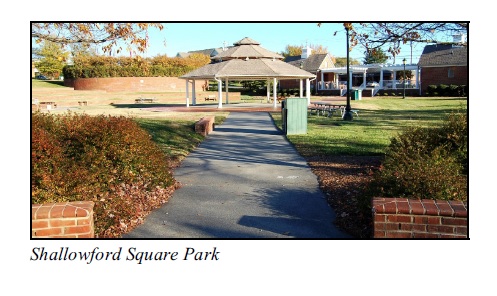
The downtown needed a catalyst and Shallowford Square provided the needed focus to spur additional development. Surveys show that residents would like to see development oriented to the Square, with street landscaping, and pedestrian amenities, all shaping the center of town.
Update 2000 built upon existing plans, policies and the desires of this community for a strong downtown. During the public visioning process, residents expressed desires for increasing retail, office, entertainment, and housing. Making downtown accessible and safe for pedestrians is also a top priority. Further extension of sidewalks would be especially valuable in the downtown area.
A review by the Planning Board in 2014 created the Downtown Development Guidelines that create/ establish an expectation on behalf of the town of what the (1) downtown should look like and (2) how the district should expand and look given certain architectural preferences.
The major goals embodied in the Parallel Road Plan and Update 2000 have been reaffirmed as presented in this Comprehensive Plan. Because of this, the 2015 Parallel Road Plan is still viable and will be extended to the year 2035.
A critical aspect of land use planning centers around future commercial development in Lewisville. The merits of expanding commercial areas outside the downtown commercial district, particularly at the eastern end of Shallowford Road where an interchange of the Northern Beltway is proposed, was debated as well as expansion of the Vienna Business District. Commercial development is appropriate for these types of locations; however, Lewisville is determined to set a different standard in order to preserve its residential character, avoid strip development and support a mixed use downtown. As Map 9 Preferred Land Use shows, commercial development is slated only for downtown and the VBD and is slightly expanded at the existing satellite areas.
While the Land Use Plan recommends some appropriate zoning districts, each development proposal must be considered on its own merit. Compatible or lower- intensity uses will be encouraged.
Vision
Lewisville in the year 2035 will continue to be committed to preserving and enhancing its character as a residential community. A variety of land uses will work together in a harmonious and sustainable fashion providing citizens with needed services for achieving a high quality of life.
Lewisville will continue to provide a variety of attractive, quality residential areas for all income levels and age groups. Open space, which defines the community’s character, is preserved through environmentally sensitive development models which balance the health and well being of all of its citizens.
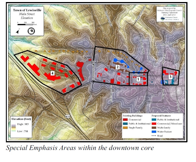
Downtown Lewisville will continue to be the heart of the community. Downtown will be pedestrian friendly and will offer a variety of retail and entertainment attractions. The parcels neighboring Shallowford Square within and surrounding the Downtown Core and downtown corridor have been designated as special emphasis areas, given their proximity and importance to their relationship to the Town’s center. Appropriate and sensitive development continues to be encouraged within these areas, with an emphasis on respecting and supporting the town’s core value as a historically unique small town with an articulated pedestrian oriented character and scale.
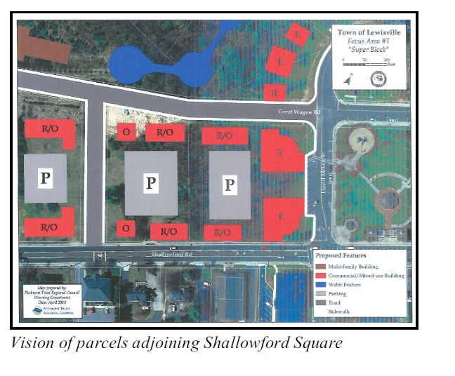
Lewisville’s Downtown Core will be comprised of those parcels bounded by Tom Voss Street, the Great Wagon Road, the extension of Lewisville-Clemmons Road to the Great Wagon Road and Shallowford Road. Shallowford Square, although not physically located in the exact center of Lewisville, will continue to be considered the heart of the town’s core. Lewisville’s downtown corridor will be comprised of parcels on either side of Shallowford Road and the future Great Wagon Road between the Oaks Shopping Center to the west and the extension of Lewisville-Clemmons Road to the Great Wagon Road to the east.
Lewisville’s downtown core, the parcels generally to the east of Shallowford Square to the future extension of Lewisville-Clemmons Road to the Great Wagon Road, will continue to be the extent of cultural, governmental, entertainment and open space uses. The Laugenour House will continue to be a critical component to remain extant within this area, re-purposed as an historic property, a symbol of the genesis of our town. With the closing of a portion of North Street, Shallowford Square has been extended to include the Laugenour House with the placement of a walkway and the inclusion of a water feature.
The parcels to the west of Shallowford Square are mixed use commercial and business, comprised of assorted retail shops, offices and restaurants in a compact and contiguous single development.
The parcels to the north of the Great Wagon Road from Shallowford Square west to Shallowford Road are transitional urban residential, comprised of lower density live/work units and/or multi-family, either as a contiguous single development or a phased project.
The parcels to the south of Shallowford Road from Shallowford Square west to Shallowford Road are a continuation of the development of small office uses within a new or re-purposed development.
Truly unique to Lewisville’s downtown is its use as a staging point for area cyclists, both recreational as well as the more experienced riders. The Town of Lewisville recognizes its responsibility as the chosen cycling hub with the larger context of connectivity with Forsyth, Davie and Yadkin counties and encourages a more synergistic alliance between the town and the riders.
Owing to a strong sense of place and history, the Vienna Business District will become a focal point for commercial activity in the northern area of the town.
The commercial area located at the interchange of Styers Ferry Road/Lewisvile-Clemmons Road/US 421, will continue to be an important addition to commerce in Lewisville. Visitors from surrounding areas will continue to be attracted to Lewisville’s charming small town businesses and village-like atmosphere.
LAND USE TERMINOLOGY
Residential
Conservation
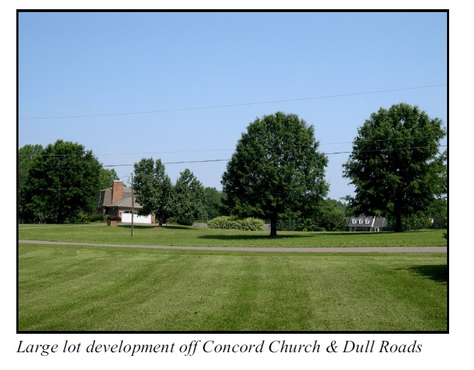
This residential land use classification calls for preserving the pastoral character of Lewisville by recommending a minimum lot size of three (3) acres. The Conrad Road area and areas along the Yadkin River are designated as the only locations for this designation. These areas epitomize the rural, agrarian character which defines Lewisville. The community strongly desires to preserve this feeling as much as possible.
Rural
This classification preserves the large lot residential patterns for outlying sections of town which cannot be easily served by sanitary sewer. The minimum lot size is two (2) acres, one (1) acre if clustered and 20% of the site is left in open space. These areas are not served by sewer, and lie within the Yadkin River watershed.
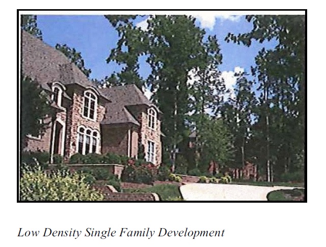
Low Density Single Family
This classification includes primarily low density single family housing with a minimum lot size of 20,000 sq. ft., 10,000 sq. ft. if clustered with 30% of the site left in open space. The overall maximum allowable density is 2.2 units per acre. Sewer service is expected where the clustering option is utilized.
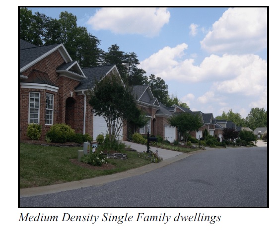
Medium Density Single Family
This classification is intended to include existing single family residential neighborhoods where sewer is already available or is proposed in the near future. The minimum lot size is 9,000 sq. ft. with a density of 4.8 units per acre. Cluster housing options (Planned Residential Development - PRD) are appropriate for this area. Affordable housing is desirable here. Generally, sewer service and lack of watershed restrictions in most areas make this more appropriate for higher density development.
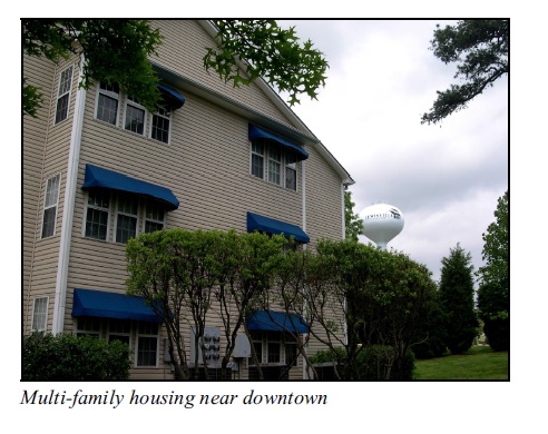
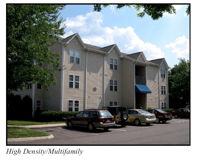
High Density/Multifamily
The multifamily classification is located on the edge of downtown where higher density housing is appropriate due to existing multifamily developments, the availability of sewer and the desire for more activity around the downtown. Appropriate uses include condominiums, duplexes, twin homes and townhouses, with a maximum density of eight (8) units per acre (UDO districts RM5 and RM8 are allowable). RSQ, which allows slightly higher density, may be appropriate as infill near or in the downtown on sites less than one acre size. Clustering is appropriate here.
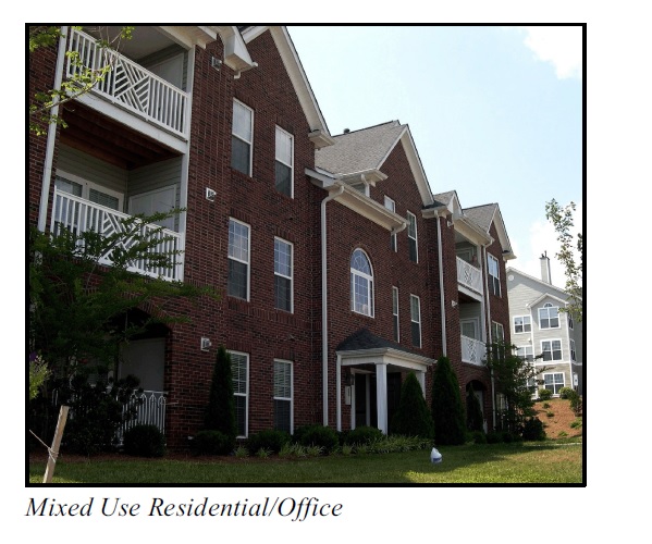
Mixed Use Residential/Office
This classification has been developed for those areas where residential structures are predominant, but would also be appropriate for limited office and institutional uses, especially since residents have expressed the need for low cost retirement facilities. Duplexes, twin homes, townhouses and low intensity office and institutional uses are desired, with a maximum density of 12 units per acre. UDO districts RSQ on lots less than one acre, RM5, RM8 and RM12, NO and LO are appropriate. Building size restrictions are needed to ensure that the scale of new development is compatible with the established residential character of the area. Clustering is also an option.
Commercial
Commercial/Office
This plan recommends maintaining several primary commercial areas outside of the downtown mixed use commercial area each with specific classifications.
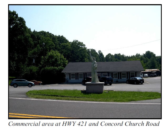
1. South of US 421/Concord Church Road Satellite
Located within the Downtown Gateway Area (DGA), design standards appropriate for vehicle dependent highway uses should be utilized to create projects that are convenient to and serve both local and highway traffic.
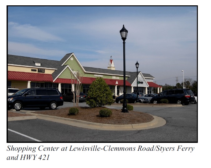
2. Corner of Lewisville-Clemmons Rd./Styers Ferry Rd./HWY 421 Satellite
This area is suitable for more intense commercial and office development. The existing HB zoning is satisfactory in this location. Additional development activity is expected to occur as properties are developed.
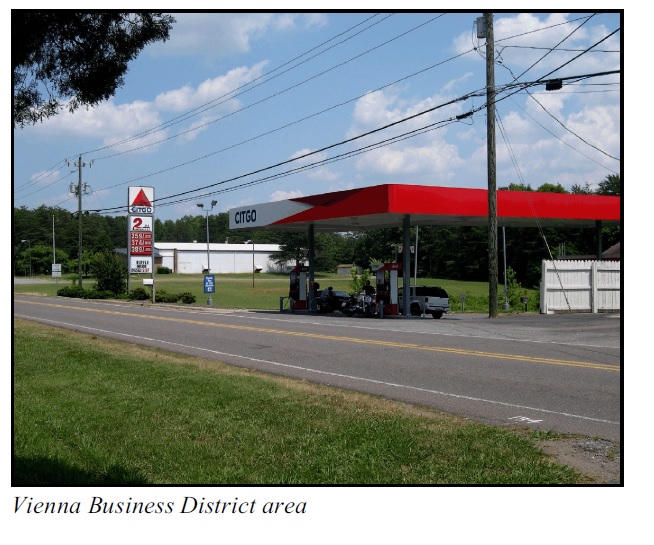
3. Vienna Business District (VBD)
The Vienna Business District encompasses the area between Glenn Ferry and Needham Road off Yadkinville Road. The VBD is a compact business district located around the historic crossroad area of Lewisville-Vienna Road and Yadkinville Road (Old US 421) and offers a mix of retail and other institutional uses.
Mixed Use
Downtown Commercial/Office/Residential
This category promotes the desire to have a diverse mix of uses in Lewisville’s downtown.
Institutional
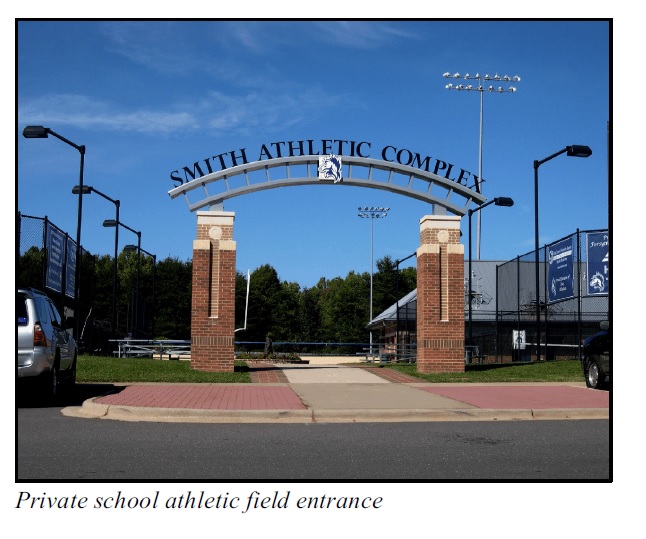
Included in this classification are public and private schools, governmental agencies and facilities, and religious institutions.
Open Space
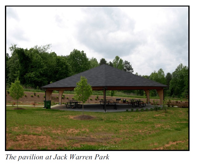
This classification includes public parks and open space.
Site Development Checklist
This checklist provides additional development standards to regulations and guidelines found in the Unified Development Ordinances (UDO) andDowntown Overlay District Planning Guideto guide certain aspects of site development, such as design and landscaping. These standards will ensure that the town’s character is protected and enhanced in accordance with the goals and objectives of the comprehensive plan.
These standards are intended to be used by developers, land owners, and planning staff when designing, preparing, and reviewing zoning requests and development proposals. These criteria will be applicable to special use zoning requests.
LANDSCAPING/TREE PRESERVATION
(See the UDO for specific details)
Encourage the use of native species trees and plants, especially for buffering and landscaping requirements.
Prohibit the removal of trees in restricted areas of floodplains and wetlands.
Development plans should incorporate into their designs identified woodlands, mature, and existing specimen trees.
Encourage the protection and replanting of native tree specimens.
Discourage the removal of specimen trees within required setbacks and buffers.
Encourage the preservation of mature and specimen trees elsewhere.
Where feasible, protect mature and specimen trees in non-buildable areas of a site, including setback areas, by fencing-off during site preparation and construction.
Discourage clear cutting of trees from construction and development sites where feasible.
It shall be the property owners responsibility to abide by stormwater management regulations and principles.
Encourage landscaping at the entrance to residential developments.
SITE DESIGN
All new on-site infrastructure street, curb and gutter, water, sanitary sewer, and stormwater management and extensions to the site shall be provided by the developer.
Place utilities underground where possible.
Prohibit construction that negatively impacts streams, lakes or wetlands.
Prohibit development within floodplains.
Develop stormwater management plans to minimize runoff volumes and pollutants. These should be prepared in conjunction with site plans.
Design in accord with natural drainage systems. Promote the use of grassy swales and other bioengineering techniques for stormwater management.
Encourage development guidelines for environmental protection.
Minimize cut and fill in developments by working with terrain and using sensitive, topographically responsive building architecture.
Encourage the protection of identified scenic views and vistas.
Discourage development from encroaching on any mapped route.
Encourage residential development where homes are clustered to preserve open space.
Encourage the identification and marking of historical sites throughout Lewisville.
Site all parking to the rear or side of the buildings whenever possible.
Seek greenway easements in new developments where designated on the Greenway and Pedestrian Plan.
Encourage the use of vegetative screens rather than solid, constructed fencing.
Screen mechanical equipment and commercial solid waste disposal containers from general public view.
Install exterior lighting at a height of more than 8 feet above the finished grade. All lighting in excess of 12 feet shall be “shoebox” style.
BUILDING DESIGN
Infill construction shall be complimentary to existing buildings of the same classification.
Limit building height to 48 feet (height of the Roller Mill) except churches and municipal buildings. (For development in the downtown area, refer to height guidelines in the Downtown Overlay District Planning Guide.)
Maintain human scale in building size and spacing.
Discourage structures with exposed metal or CMU walls.
TRANSPORTATION/CIRCULATION
Developers shall be required to repair or pay for damage to roads caused by construction.
Discourage transportation network improvements, water, sewer, gas and cable extensions in environmentally sensitive areas to those which are required to protect the general public safety.
Implementation Program
Recommended Action | Action Steps | Responsible Agency | Time Frame |
Recommended Action | Action Steps | Responsible Agency | Time Frame |
Goal - Facilitate land use patterns that offer a variety of housing and land use choices and convenient access to neighborhood shopping and other services; protect property owners from incompatible land uses; make efficient use of Lewisville’s limited land capacity; and coordinate land uses with infrastructure needs. | |||
LU1 - Develop Lewisville in accordance with Map 9 Preferred Land Use. | * Apply land use policies in zoning & development policies. * Apply the standards of the Site Development Checklist contained within this chapter to ensure the vision and goals of this plan are achieved. | TC PB Staff | Ongoing |
LU2 - Encourage the preservation of the natural character of the Yadkin River/Conrad Road corridor. | * Make land use decisions to preserve natural character. | TC PB Staff | Ongoing |
LU3 - Conduct an ongoing review of Map 9 Preferred Land Use to ensure responsiveness to outside influences and community changes such as annexation, annexation agreements and roadway improvements and sewer and water extensions. | * Review. * Revise. * Adopt. | TC PB Staff | Ongoing |
LU4 - Encourage responsible commercial development in the downtown and other established commercial areas. | * Follow Map 9 Preferred Land Use and adopted policies. | TC PB Staff | Ongoing |
LU5 - All new construction will comply with Stormwater Management Plan. | * Plan review and approval by responsible agency. | TC PB Stormwater Administrator | Ongoing |
LU6 - Support design standards in the development of the downtown area. | * Continue to monitor, update and enforce design regulations. * Utilize the Downtown Development Guidelines in reviewing future projects. * Apply the standards of the Site Development Checklist contained within this chapter to ensure the vision and goals of this plan are achieved. | TC PB Staff | Ongoing |
LU7 - Ensure that existing home- based businesses and services located in residential areas are compatible with surrounding development. | * Review/enforce UDO home- base business provisions. | TC PB Staff Inspections | Ongoing |
LU8 - Develop a lighting ordinance to control outdoor light pollution and protect Lewisville’s rural night sky. | * Research similar regulations. * Develop criteria. * Hold public hearing/adopt guidelines. * Promote and educate developers and citizens. | TC PB Staff | Immediate |
* Research regulations. * Develop criteria. * Hold public hearings/adopt guidelines. * Promote and educate developers and citizens. | TC PB Staff | Immediate | |
Goal - Ensure that standards for quality housing are met. | |||
LU10 - Continue to require enforcement of codes for construction of new units and maintenance of existing structures.
|
* Continue to contract with the WS/FC Inspections Department for NC Building Code and zoning enforcement. | Staff Inspections | Ongoing |
Goal - Identify areas and zone appropriately to support higher density housing in some parts of town. | |||
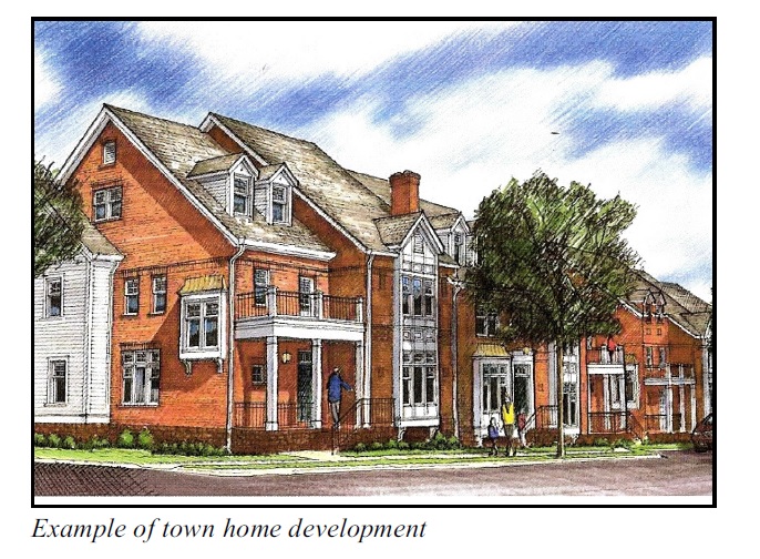
LU11 - Allow for higher density zoning surrounding the downtown area, such as town homes. | *Zone to facilitate higher density housing in identified locations as supported by infrastructure such as sewer. * Determine implementation opportunities. | TC PB Staff | Ongoing |
LU12 - Allow for higher density developments in designated areas while preserving the character of the town.
|
* Define additional standards developers can meet. * Amend UDO to allow performance standard/density trade-off performance standard. | TC PB Staff | Ongoing |
LU13 - Encourage higher density development around the proposed schools to be built along Robinhood Road that is well connected to the school campus and nearby neighborhoods. | * Utilize MU-S zoning to create new residential development that is unique to the area having varied densities and housing types. | TC PB Staff | Ongoing |
Goal - Encourage the development of high quality neighborhoods that foster a greater sense of community through enhanced connectivity. | |||
LU14 - Continue to require neighborhood street connections but design traffic plans to minimize negative cut through traffic.
|
* Apply appropriate design standards and ordinances to ensure safe and effective connections between residential develops. | LTC PB Staff | Ongoing |
Goal - Require high standards for appearance of residential developments. | |||
LU15 - Require increased rear yard and side yard setbacks along major thoroughfares and restrict or have limited access to major thoroughfares. | * Research. * Determine setbacks. * Amend UDO. | TC PB Staff | Ongoing |
LU16 - Emphasize the need for high quality trees that enhance the quality of life by providing economic and environmental benefits to the neighborhood and community at large. | * Utilize the landscaping standards in the UDO. | TC PB Staff LBC | Ongoing |
LU17 - Require parking for multi- family to be to the rear of the structures or screened from the road. | * Amend UDO to require. | TC PB Staff | Ongoing |
LU18 - Provide additional landscaping and higher appearance standards for residential developments, especially multi- family developments. | * Review standards and amend the UDO as required. | TC PB Staff | Ongoing |
LU19 - Encourage housing and neighborhoods that are developed consistent with environmental and sustainability standards. | * Town planner will assess, develop and implement standards for traditional neighborhood development (TND) model to be integrated into the town plan as deemed appropriate. * Town planner will evaluate the appropriateness of MU-S zoning in creating a mixed use TND type project. | PB Staff | Long Term |
Goal - The downtown establishes a community focus and identity for Lewisville. | |||
LU20 - Explore public school bus stops and safe routes to school in new developments. | * Meet with school system representatives to discuss opportunities. | Staff PB TC | Ongoing |
LU21 - Enhance visual quality in the downtown. Continue to monitor architectural standards in all applicable commercial districts.
|
* Utilize the downtown development guidelines in reviewing future projects. | Staff PB TC LBC | Ongoing |
LU22 - Maintain the Downtown Banner program. | * Maintain the program by purchasing additional banners and consider the expansion of the program to the Vienna Business District. | LBC | Ongoing |
Goal - The downtown is vibrant and active with commercial, office, entertainment and residential development. | |||
LU23 - Explore ways to encourage public and private partnerships where appropriate that support the planned development and marketing of downtown. Build strong public/private partnerships with community business leaders. | * Undertake program to work with local business association and civic groups. * Explore the creation of an economic development committee comprised of public/private leadership. | Staff TC | Ongoing |
LU24 - Encourage work/live development in all commercial districts | * Support continued mixed use housing in all suitable districts. | Staff PB TC | Ongoing |
LU25 - Actively investigate and apply for grants to serve as funding sources for implementing desired programs. | * Identify grant programs. * Apply for desired program funding. | Staff TC Experienced Grant Specialist(s) | Ongoing |
LU26 - Encourage the preservation and conversion of existing homes to new uses as appropriate | * Rezone as needed. | Staff PB TC LHS | Ongoing |
LU27 - Review and revise the applicable downtown district as necessary to implement the vision of the community for quality development. | * Review/revise downtown development standards as necessary. * Place on Planning Board work session agendas | PB TC Staff | Ongoing |
Goal - Downtown Lewisville offers a comfortable, safe, and interesting pedestrian environment. | |||
LU28 - Follow design guidelines for the public spaces identified in the applicable downtown district. Public space guidelines would address design elements to help create unity and a pedestrian- friendly environment. Elements to be addressed may include: utilities, sidewalks, streetlights, furniture, decorations, trash cans, planters/flower pots, trees/ landscaping, banners, fences, signage (directional and street signs), and other special features of choice. | * Fund and implement improvements. * Monitor future needs. * Utilize the Downtown Development Guidelines in reviewing future projects. | Staff TC PB LBC | Ongoing |
Goal - Developing the area around Shallowford Square is a primary objective of the community. | |||
LU29 - Apply applicable downtown district design guidelines and recommendations when developing the core of downtown around the Shallowford Square. (Also see Figure 2.) | * Apply during rezoning process. * Verify site plan compliance. * Retain and preserve the town’s unique character with an emphasis on creating an active and livable town center that reflects its rich heritage. | TC PB Staff | Ongoing |
Goal - Encourage development in the Vienna Business District | |||
LU30 - Review the Vienna Small Area Plan to determine implementation opportunities. | * Encourage the application of VBD guidelines and zoning within the business district. * Conduct periodic community meetings within the district to discuss goals and implementation. * Assess the feasability of recreational opportunities in the Vienna area. | PB Staff | Ongoing |
Time Frame: Immediate = directly - without delay Annually = once each year Short Term = within 5 years Long Term = within 5-10 years Ongoing = continuous | |||