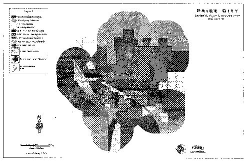
Price City land uses are divided into the categories of residential, commercial, industrial and special districts (see "General Plan Land Use Map, Exhibit 3", of this section). Each category is divided into land use classifications, as follows:
A. Residential:
1. Rural Density (Zones Included: RR): The rural density residential (RDR) classification is for residential uses in areas where a rural atmosphere, open space preservation and agriculture uses are encouraged. The housing density should not exceed one unit per gross acre. Exceptions to this maximum density may be permitted as conditional use, subject to the clustering of housing and provision of meaningful open space.
2. Low Density (Zones Included: SF-12, SF-8): The low density residential (LDR) classification is for typical low density suburban neighborhoods with single-family homes on individual building lots. The housing density should not exceed four (4) units per gross acre.
3. Medium Density (Zones Included: SF-6, MR-7): The medium density residential (MDR) classification is for smaller individual home lots and multiple-family housing units such as duplexes, townhomes and other types of small scale attached housing units. The housing density should not exceed seven (7) units per gross acre.
4. High Density (Zones Included: MR-11): The high density residential (HDR) classification is for multi-family development, such as apartment and condominium complexes, with an overall housing density in excess of seven (7) units per gross acre.
B. Commercial:
1. Community Commercial (Zones Included: N-C, S-C, GC): The community commercial (CC) classification is for general shopping facilities to satisfy the shopping needs of the community for a particular neighborhood. The intensity of the commercial zone applied will depend on such factors as the nature and location of surrounding uses, the ability to buffer surrounding uses, and the availability of necessary infrastructure.
2. Highway Commercial (Zones Included: H-C): The highway commercial (HC) classification is for commercial and service uses serving the needs of thoroughfare traffic and the traveling public in locations adjacent to highways or major streets.
C. Industrial:
1. Light Industrial (Zones Included: M-D): The light industrial (LI) classification is intended to provide for clean and less intensive industrial, manufacturing and technological uses. Facilities and operations to take place within this designation should be designed to protect the environmental quality of adjacent areas.
2. Heavy Industrial (Zones Included: M-G): The heavy industrial (HI) classification is for a range of industrial and manufacturing uses, including heavy industry. The intensity of the manufacturing uses and corresponding zoning will depend on surrounding uses, existing infrastructure and the ability to buffer and protect adjacent or nearby residential uses.
D. Special Districts:
1. Public Facilities (Zones Included: PF): A special district is established to promote the effective planning and development of public facilities and mixed land uses.
2. Special Planned Districts (Zones Included: CD, PL): Provision is made for the establishment of special planned districts, allowing for mixed and special development uses which may vary from zoning regulations, but which will be a desirable asset to the community.
3. Overlay Districts (Zones Included: SA, DRA): Overlay districts do not fall within a general plan classification since they are intended to mix additional uses, limitations or designations with those allowed in the underlying zoning, in various areas throughout the city. Overlay zones are intended to be applied only when the overlay meets articulated needs of the city.
(Ord. 2004-001, 2004)