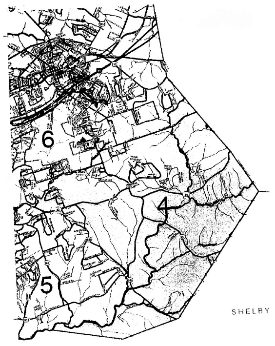
Being bounded on the north by Magisterial District 3, on the east by Henry County, on the southeast and south by Shelby County and on the west by Magisterial Districts 5 and 6, and being more particularly described as follows:
Beginning at the intersection of Kentucky Highway 53 (First Avenue) and Kentucky Highway 146 (Jefferson Street) and being a corner with Magisterial Districts 6 and 3; thence with the lines of District 3 for the following courses:
north with Highway 53 to the intersection with Water Works Road;
northeast with Water Works Road past Keane Avenue to the intersection with the corporate boundary of the City of La Grange (January 1, 2011);
southeast and northeast with the City of La Grange to the intersection with Kentucky Highway 1855 (Fort Pickens Road);
southwest with Highway 1855 to the intersection with the CSX Transportation Railroad;
east and northeast with CSX Railroad to the intersection with Spann Lane; and
east with Spann Lane to the intersection with the Henry County boundary;
thence south and southeast with the Henry County boundary to its intersection with the Shelby County boundary; thence southwest and west with the Shelby County boundary to the intersection with Floyds Fork and being a corner with Magisterial District 5; thence with the lines of District 5 for the following courses:
northeast (upstream) with Floyds Fork to the intersection with an unnamed tributary;
north (upstream) with the unnamed tributary to the intersection with Kentucky Highway 1818 (East Mount Zion Road);
northeast with Highway 1818 to the intersection with Kentucky Highway 2859 (Fible Lane);
northwest with Highway 2859 to the intersection with Kentucky Highway 22; and
west with Highway 22 to its intersection with an unnamed tributary to the
South Fork of Currys Fork and being a corner with Magisterial District 6; thence with the lines of District 6 for the following courses:
northwest (downstream) with the unnamed tributary to the intersection with the South Fork of Currys Fork;
northeast (upstream)with the South Fork of Currys Fork to the third intersection with an unnamed tributary;
north (upstream) with the unnamed tributary to the intersection with Kentucky Highway 2856 (Moody Lane);
east with Highway 2856 to the intersection with Kentucky Highway 53; and north and northwest with Highway 53 (becoming First Avenue) to the beginning.
(Ord. KOC 11-200-055, passed 8-16-2011)