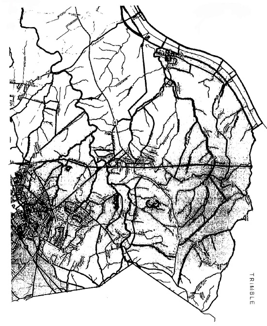
Being bounded on the northwest by the State of Indiana, on the northeast by Trimble County, on the east by Henry County, on the southeast by Magisterial Districts 4 and 6 and on the southwest by Magisterial District 2, and being more particularly described as follows:
Beginning at the intersection of U S. Highway and Kentucky Highway 393 and being in the line of Magisterial District 2; thence northwest with a private driveway and its extension and with the line of District 2 to the state boundary between Indiana and Kentucky in the Ohio River; thence northeast (upstream) with the state boundary to a northwest extension of Pattons Creek and the Trimble County line; thence east and southeast with Trimble County and upstream with Pattons Creek to the intersection with the Henry County line; thence southwest and south with Henry County to its intersection with Spann Lane and being a corner with Magisterial District 4; thence with the lines of District 4 for the following courses:
west with Spann Lane to the intersection with the CSX Transportation Railroad;
southwest with the CSX Railroad to the intersection with Kentucky Highway 1855 (Fort Pickens Road);
northeast with Highway 1855 to the intersection with the corporate boundary of the City of La Grange (January 1, 2011);
northwest with the City of La Grange to the intersection with Water Works Road; southwest with Water Works Road to the intersection with Kentucky Highway 53 (First Street); and
south with Highway 53 to the intersection with Kentucky Highway 146 (East
Jefferson Street) and being a corner with Magisterial District 6; thence west with Highway 146 and District 6 to the intersection with the corporate boundary of the City of La Grange (January 1, 2011) and being a corner with District 2; thence with the lines of District 2 for the following courses:
northwest with the City of La Grange to the intersection with the North Fork of Cedar Creek;
northwest (downstream) with the North Fork of Cedar Creek to the intersection with Harrods Creek;
southwest (downstream) with Harrods Creek to the intersection with Kentucky Highway 393; and
northwest with Highway 393 to the beginning.
(Ord. KOC 11-200-055, passed 8-16-2011)