Loading...
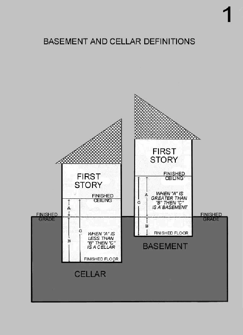
(A) Basement: Figure 1.
Figure 1
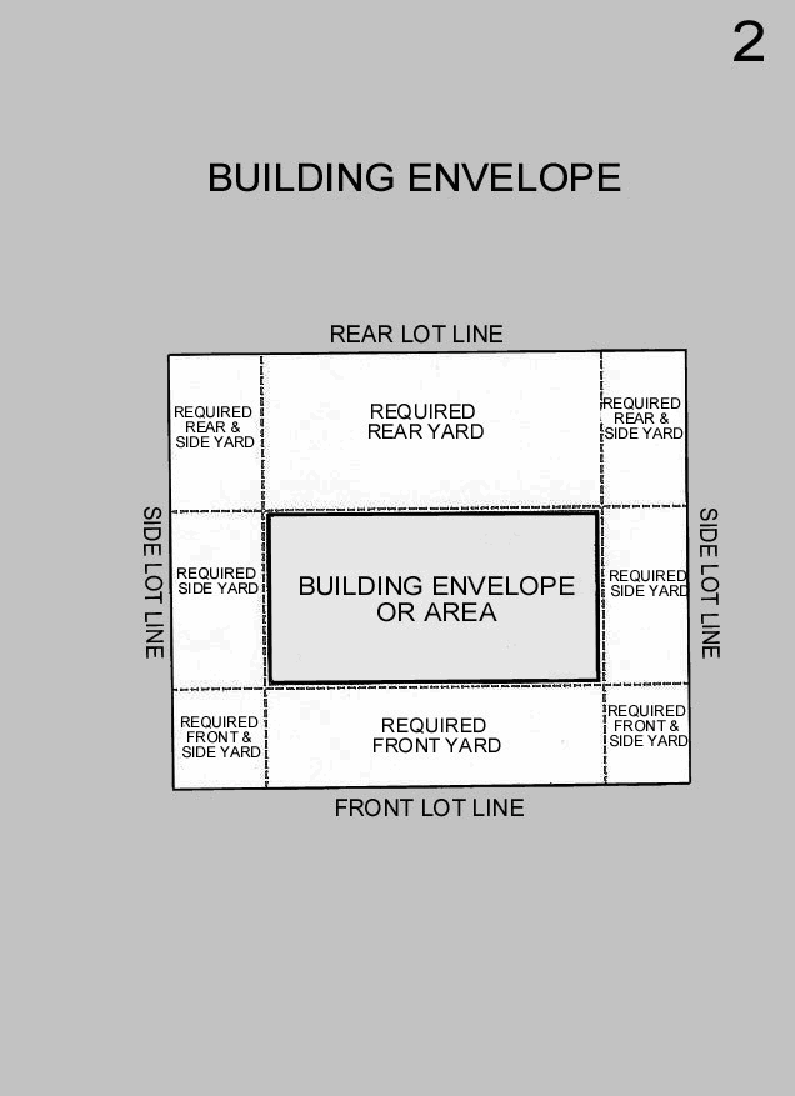
(B) Building envelope: Figure 2.
Figure 2
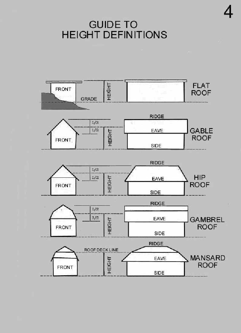
(C) Building height: Figure 3 and Figure 4.
Figure 3
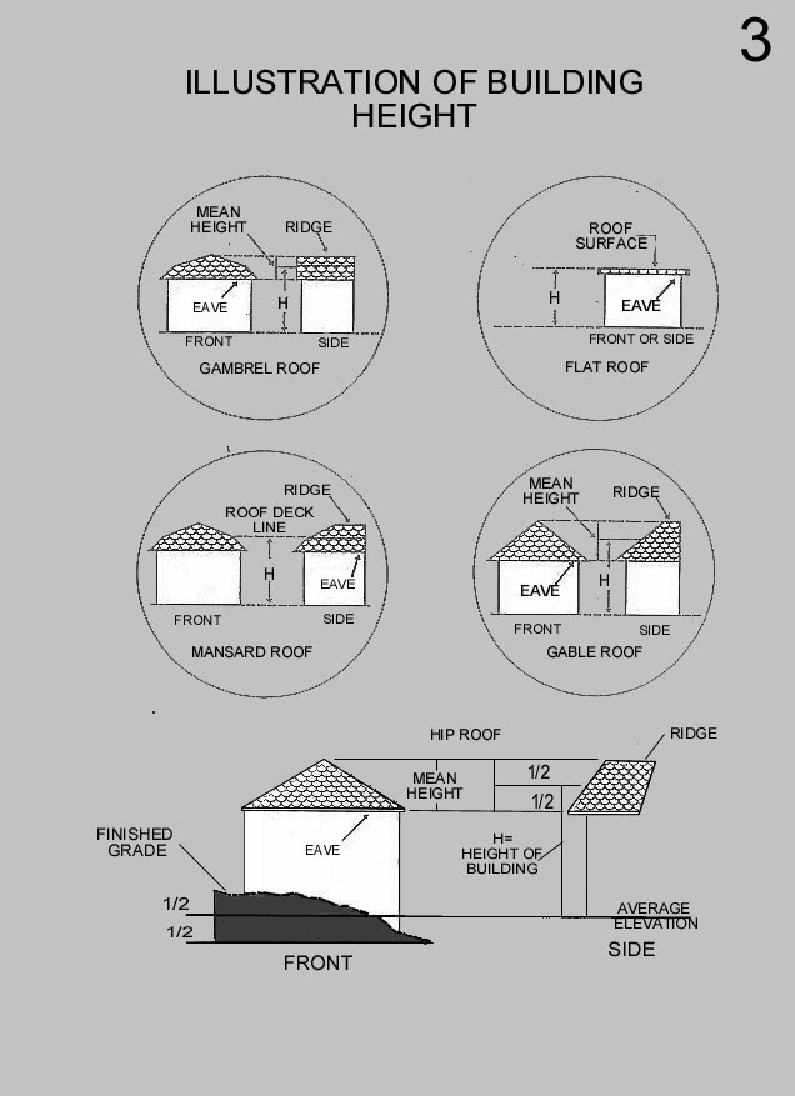
Figure 4
(D) Cellar: Figure 3.
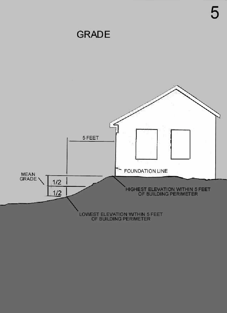
(E) Grade: Figure 5.
Figure 5
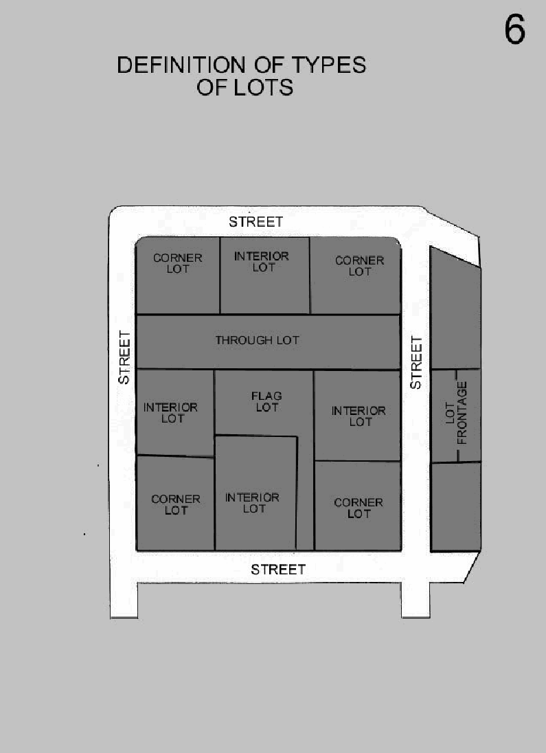
(F) Lot: Figure 6.
Figure 6
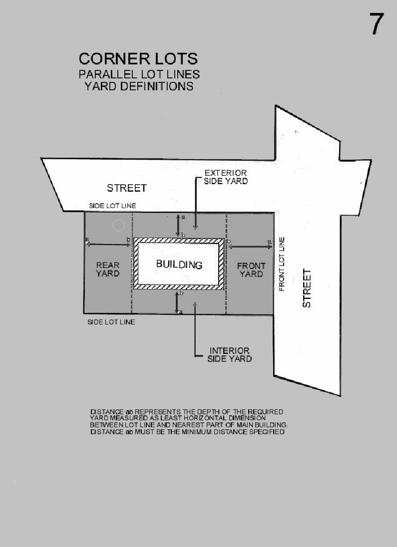
(G) Lot, corner: Figure 7.
(H) Lot depth: Figure 7.
Figure 7
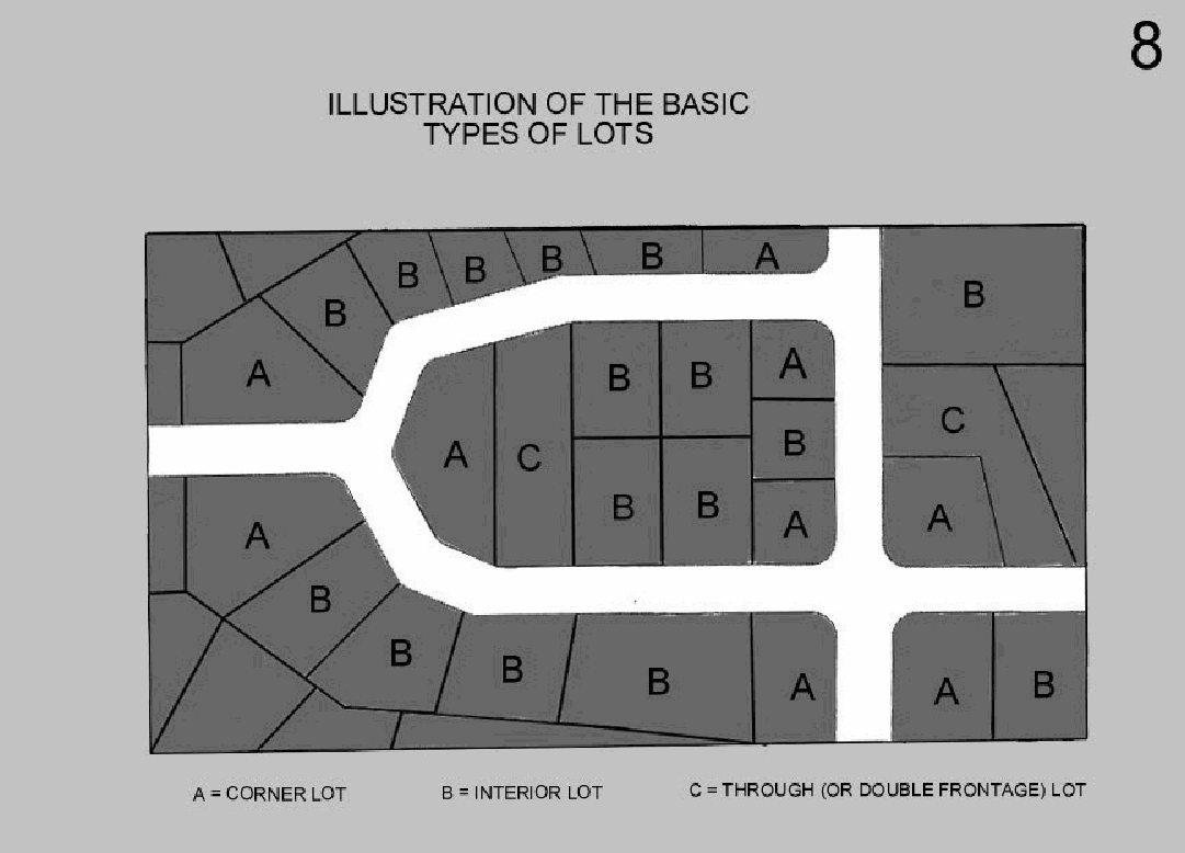
(I) Lot, double frontage: Figure 8.
Figure 8
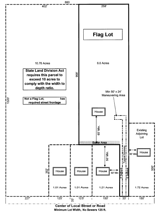
(J) Lot, flag: Figure 13.
Figure 13
(K) Lot lines: Figure 7 and Figure 8.
(L) Lot width: Figure 7 and Figure 8.
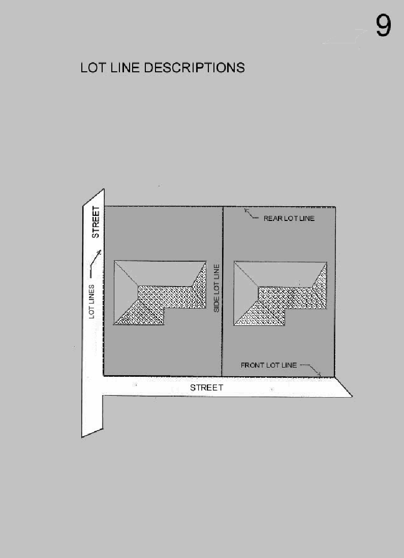
(M) Lot line, front: Figure 9.
(N) Lot line, rear: Figure 9.
(O) Lot line, side: Figure 9.
Figure 9
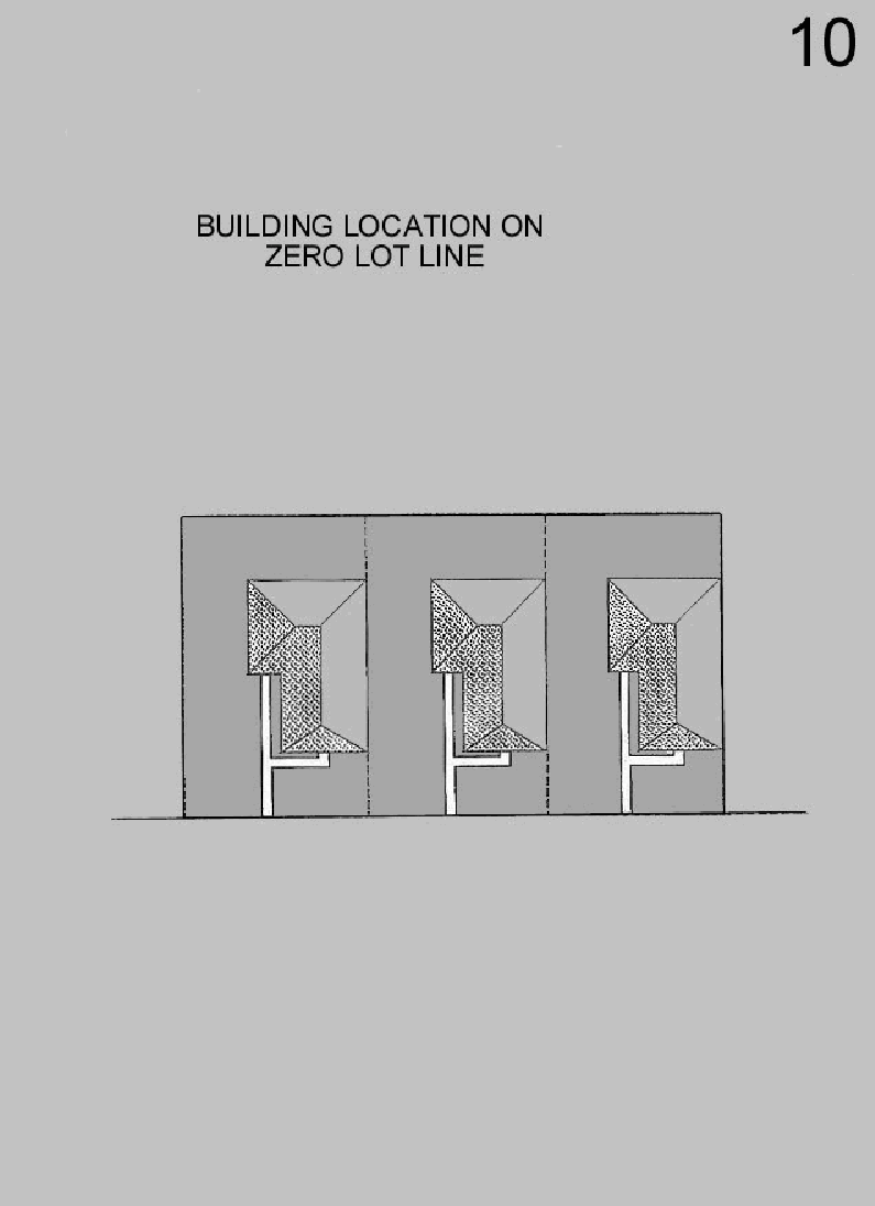
(P) Lot line, zero: Figure 10.
Figure 10
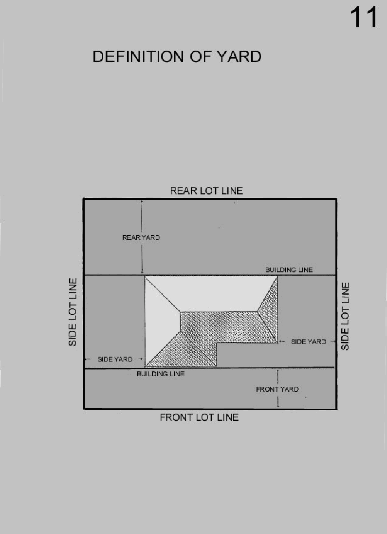
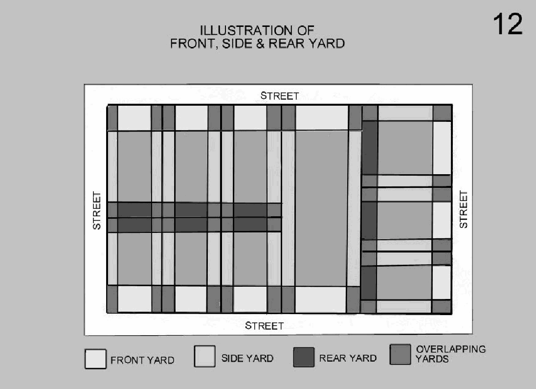
(Q) Yard: Figure 11.
Figure 11
(R) Yard, front: Figure 12.
(S) Yard, rear: Figure 12.
(Y) Yard, side: Figure 12.
Figure 12
ILLUSTRATION OF FRONT, SIDE & REAR YARD
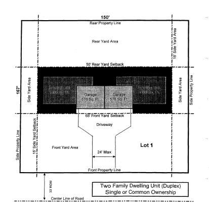
(Z) Dwelling, two-family (duplex): Figure 13.
Figure 13
(Ord. 99, passed 11-18-1996, § 2.03; Am. Ord. 152, passed 1-16-2007)
ZONING DISTRICTS AND ZONING MAP
For this purpose of this chapter, the Charter Township of Montrose is hereby divided into the following districts.
Residential Districts | Nonresidential Districts |
AG Agricultural | R/C Recreation/Conservation |
RF Residential Farm | O/S Office/Service |
RS Residential Suburban | C-1 Neighborhood Commercial |
RM Multiple-Family | C-2 General Commercial |
MHP Mobile Home | I-1 Light Industrial |
MHP Manufactured Home Park | I-2 Heavy Industrial |
(Ord. 99, passed 11-18-1996, § 3.01)
(A) The boundaries of these districts are hereby established as shown on the zoning map which accompanies this chapter, and which map, with all notations, references, and other information provided, shall be as much a part of this chapter as if fully described in the text.
(B) The zoning map shall be kept on display in the Township Hall and descriptions accompanying enacted amendments to the zoning map shall be displayed adjacent to the map until a time as the map is corrected.
(Ord. 99, passed 11-18-1996, § 3.02)
Where uncertainty exists with respect to the boundaries of the various districts as shown on the zoning districts map, the following rules shall apply.
(A) Boundaries indicated as approximately following the centerlines of the streets, highways, or alleys, shall be construed to follow the centerlines.
(B) Boundaries indicated as approximately following platted lot lines shall be construed as following the lot lines.
(C) Boundaries indicated as approximately following corporate limits shall be construed as following corporate limits.
(D) Boundaries indicated as following railroad lines shall be construed to be the midway between the main tracks.
(E) (1) Boundaries indicated as parallel to or extensions of features indicated in divisions (A) through (D) above shall be so construed.
(2) Distances not specifically indicated on the official zoning map shall be determined by the scale of the map.
(F) Where physical or natural features existing on the ground are at variance with those shown on the official zoning map, or in other circumstances not covered by divisions (A) through (E) above, the Board of Appeals shall interpret the district boundaries.
(G) Insofar as some or all of the various districts may be indicated on the zoning map by patterns which, for the sake of map clarity, do not cover public rights-of-way it is intended that the district boundaries do extend to the center of any public right-of-way.
(Ord. 99, passed 11-18-1996, § 3.03)
Whenever any street, alley or other public way, within the Charter Township of Montrose shall be vacated, the street, alley, or other public way or portion thereof, shall automatically be classified in the same zoning district as the property to which it attaches.
(Ord. 99, passed 11-18-1996, § 3.04)
AGRICULTURAL DISTRICT (AG)
(A) This district is established to regulate those areas of the township whose best use is for agricultural production and related activities.
(B) The regulations of this district are designed to conserve, stabilize, and enhance farming and related resource utilization activities, to minimize conflicting uses of parcels, lots and structures detrimental to or incompatible with these activities.
(C) The district, in seeking to conserve areas for agricultural uses, is designed to prevent urban sprawl and the fragmentation of agricultural resources through insensitive subdivision design.
(Ord. 99, passed 11-18-1996, § 4.01)
No structure or part thereof shall be erected, altered, or used and no land may be used except for 1 or more of the following purposes:
(A) Farming, including the raising or growing of:
(1) Forages and sod crops;
(2) Grains and feed crops;
(3) Dairy and dairy products;
(4) Livestock, including breeding and grazing;
(5) Fruits;
(6) Vegetables;
(7) Plants, trees, shrubs, and nursery stock; and
(8) Similar bona fide agricultural enterprises or use of land and structure.
(B) Truck gardening, involving the growing of fruits and vegetables that are intended to be distributed and sold to consumers as fresh produce;
(C) Sale and service of machinery used in agricultural production;
(D) Facilities for the centralized bulk collection, storage, and distribution of agriculture products to wholesale and retail markets;
(E) Facilities for the storage and sale of seed, fertilizer, and other products essential to agricultural production;
(F) Facilities for the research and testing of agricultural products and techniques;
(G) Single-family residential dwellings;
(H) Family day care homes;
(I) Township buildings and uses;
(J) Cemeteries;
(K) Public utility buildings and uses; and/or
(L) Accessory buildings, structures, and uses customarily incidental to any of the above permitted uses.
(Ord. 99, passed 11-18-1996, § 4.02)
Loading...