As used in this subchapter, unless the context otherwise requires:
AIRPORT.
The Littlefork Municipal Airport located in the North one half of the Southeast Quarter (N 1/2 SE 1/4) and the Southwest Quarter of the Southeast Quarter (SW 1/4 SE 1/4) of Section Five (5), Township Sixty-eight (68) North and Range Twenty-five (25) West of the 4th. Principal Meridian.
AIRPORT ELEVATION.
The established elevation of the highest point on the usable landing area which elevation is established to be 1,132.00 feet above mean sea level.
AIRPORT HAZARD.
Any structure or tree or use of land which obstructs the airspace required for, or is otherwise hazardous to, the flight of aircraft in landing or taking off at the airport; and any use of land which is hazardous to persons or property because of its proximity to the airport.
DWELLING.
Any building or portion thereof designed or used as a residence or sleeping place of one or more persons.
HEIGHT.
For the purpose of determining the height limits in all zones set forth in this subchapter and shown on the zoning map, the datum shall be mean sea level elevation unless otherwise specified.
LANDING AREA.
The area of the airport used for the landing, taking off or taxiing of aircraft.
NONCONFORMING USE.
Any pre-existing structure, tree, natural growth, or use of land which is inconsistent with the provisions of this subchapter or an amendment hereto.
NONPRECISION INSTRUMENT RUNWAY.
A runway having an existing or planned straight-in instrument approach procedure utilizing air navigation facilities with only horizontal guidance, and for which no precision approach facilities are planned or indicated on an approved planning document.
PERSON.
An individual, firm, partnership, corporation, company, association, joint stock association, or body politic, and includes a trustee, receiver, assignee, administrator, executor, guardian, or other representative.
PLANNED.
As used in this subchapter, refers only to those proposed future airport developments that are so indicated on a planning document having the approval of the Federal Aviation Administration, the Department of Aeronautics, and City of Littlefork.
RUNWAY.
Any existing or planned paved surface or turf covered area of the airport which is specifically designated and used or planned to be used for the landing and/or taking off of aircraft.
SLOPE. Means an include from the horizontal expressed in an arithmetic ratio of horizontal magnitude to vertical magnitude.
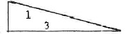
slope = 3:1 = 3 Ft. horizontal to 1 Ft. vertical
STRUCTURE.
An object constructed or installed by man, including, but without limitations, buildings, towers, smokestacks, and overhead transmission lines.
TRAVERSE WAYS.
For the purpose of determining height limits as set forth in this subchapter shall be increased in height by 17 feet for interstate highways; 15 feet for all other public roadways; 10 feet or the height of the highest mobile object that would normally traverse the road, whichever is greater, for private roads; 23 feet for railroads; and for waterways and all other traverse ways not previously mentioned, an amount equal to the height of the highest mobile object that would normally traverse it.
TREE.
Any object of natural growth.
UTILITY RUNWAY.
A runway that is constructed for and intended to be used by propeller-driven aircraft of 12,500 pounds maximum gross weight and less.
VISUAL RUNWAY.
A runway intended solely for the operation of aircraft using visual approach procedures, with no straight-in instrument approach procedure and no instrument designation indicated on an approved planning document.
WATER SURFACES.
For the purpose of this subchapter, shall have the same meaning as land for the establishment of protected zones.
(Ord. 68, passed 1-11-1979)