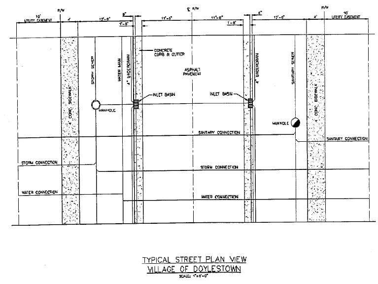
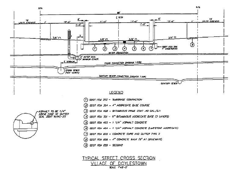
(a) General. The arrangement, character, extent, width, and location of all streets shall conform to the current Comprehensive Plan for the Village of Doylestown. The design of proposed streets shall provide for both the continuation of existing streets and access to adjacent, unplatted lands so that the entire area can be served with a coordinated street system. Residential streets shall be designed to discourage through traffic which may use secondary or major highways and whose origin or destination is not within the subdivision.
(b) Intersections. Streets shall be laid out to intersect as nearly as possible at right angles. No angle of intersection involving a Major Highway shall be less than eighty (80) degrees and no street shall intersect any other street at an angle of less than seventy-five (75) degrees. Intersections containing more than four approaches shall be discouraged. The centerlines of opposing streets shall be aligned whenever possible, otherwise, said centerlines shall be offset a minimum of one hundred fifty (150) feet.
(c) Horizontal and Vertical Alignment. Horizontal and vertical alignment shall meet the following minimum standards:
Minor | ||||
Major Highway | Secondary Highway | Collector | Street | |
Minor | ||||
Major Highway | Secondary Highway | Collector | Street | |
Minimum centerline radius | 500 feet | 300 feet | 300 feet | 200 feet |
Minimum sight distance (horizontal and vertical) | 500 feet | 300 feet | 300 feet | 200 feet |
Minimum gradient | 0.5% | 0.5% | 0.5% | 0.5% |
Maximum gradient | 5.0% | 6.0% | 7.0% | 8.0% |
Maximum vertical curve length | 100 feet | 100 feet | 50 feet | 50 feet |
Required cross slope | 3/8 inch/foot | 3/8 inch/foot | 3/8 inch/foot | 3/8 inch/foot |
Minimum tangent between reverse curves | 100 feet | 100 feet | 50 feet | 50 feet |
Minimum corner radii | 50 feet | 50 feet | 30 feet | 30 feet |
(Ord. 98-28. Passed 9-1-98.)
(d) Right-of-Way Widths. The width of street rights-of-way shall conform to the following:
Street Classification | Minimum Right-of-Way (feet) |
Major Highway | 100 |
Secondary Highway | 60 |
Collector | 60 |
Minor Street | 60 |
Alley | As determined by Planning Commission |
Cul-de-sac (less than 500 ft.) | As determined by Planning Commission |
(Ord. 2002-25. Passed 7-16-02.)
(e) Cul-de-Sacs and Dead End Streets. Streets designed to be permanently dead-ended shall not be longer than 1,000 feet and shall be provided at the closed end with a turnaround having an outside pavement radius of at least fifty (50) feet and a right-of-way radius of at least sixty-two (62) feet.
If such a cul-de-sac street is of a temporary nature and a future extension into adjacent land is anticipated, then the turning circle beyond the normal street width shall be in the nature of an easement over the premises included in the turning circle but beyond the boundaries of the street proper. Such easements shall be automatically vacated to abutting property owners, when the dead end street is legally extended into adjacent land. If such dead-end street extends only one lot depth past a street intersection, no turnaround will be required.
The subdivider shall be required to reserve for public use a strip of land five (5) feet in width at the end of all temporary dead-end streets. No person or persons shall have access across this property until an adjacent subdivision is developed and streets in such development are dedicated for public use. The cost of paving said strip shall be borne by the subdivider connecting into such streets.
(f) Street Names. Street names shall be as approved by the Planning Commission. Names shall not duplicate existing street names. The Commission may adopt policies, as deemed appropriate, to guide the naming of streets.
(Ord. 98-28. Passed 9-1-98.)

