Loading...
(A) General. The IIM Intense Industrial Zone is created to include heavy manufacturing uses and Industrial Parks. Industrial Parks refer to industrial subdivisions not less than five acres in area developed in accordance with the City Comprehensive Plan.
(B) Permitted uses. No building, structure or land shall be used and no building or structure shall be hereafter erected structurally altered, enlarged or maintained except for the following uses:
(1) Uses permitted in all Business and Industrial Zones;
(2) Manufacturing of steel, tin, or glass containers;
(3) Manufacturing of cement, lime, and gypsum;
(4) Open hearth, blast furnaces;
(5) Coke ovens, creosote manufacturing;
(6) Fat rendering, fertilizer manufacturing;
(7) Slaughtering and food processing;
(8) Manufacturing of explosives, matches, fireworks;
(9) Storage of petroleum products;
(10) Manufacturing of chemicals, detergents, soaps;
(11) Foundries;
(12) Manufacturing of railroad equipment, repair, and services;
(13) Utility pole yards and pipe yards;
(14) Motor truck terminals over ten docks or bays subject to the performance standards set forth in this chapter; and
(15) Paper box and paper products manufactured from finished paper.
(C) Performance standards. The same performance standards set forth in § 152.059(H), shall apply to the IIM Intense Industrial Zone.
(D) The plan for an industrial park. Any person, group of persons, organization, or corporation contemplating the development of an Industrial Park Zone or seeking a change in zone for the purpose of development of such zone, shall file a complete site plan, accurate and to scale, showing how the project is to be carried out. Attractiveness, compatibility, and flexibility of design shall be fundamental areas studied by the Plan Commission in making its determination.
(1) The plan shall include street design, building arrangement, off-street parking and loading, accessory uses and facilities, topography, and setback requirements.
(2) The plan shall contain maximum building coverage of not more than 45% of the total area of the lot.
(3) The developer of an industrial park shall provide a system of sanitary sewers and a system of municipal or privately owned water supply.
(4) Should the proponents of an industrial park be seeking departures from applicable provisions of this chapter, they shall submit reasons justifying such departures.
(E) Procedure. The same procedure as for attaining a proposed zone change shall be followed by the Plan Commission in making a determination as to whether or not an application for industrial park zoning should be favorably recommended, including public hearings.
(Ord. 1991-07, passed 1-7-1991) Penalty, see § 10.99
(A) General. Certain areas in the city, under existing conditions, are unsuitable for permanent occupancy being subject to periodic inundation. The purpose of the FA Flood Area Zone is to safeguard human life and property from the dangers of flood and avoid the losses both in life and wealth which may occur. The city has adopted an ordinance to control flood hazard areas which should be read in conjunction with this zoning chapter. The city’s ordinance for flood hazard area shall take precedence and be superior to the terms herein only if there is determined to be an ambiguity or duplication.
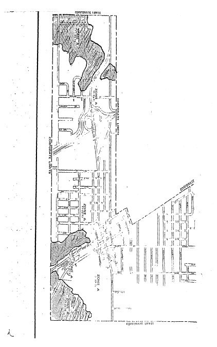
(B) Boundaries. The boundaries of the FA Flood Area Zone have been determined from data obtained from the Louisville District of the Corps of Engineers of the Department of the Army and the Federal Emergency Management Agency. Such boundaries run on the west side of the city from State Road 256 south to York Road and on the south side of the city from the intersection of Cross Street and High Street south to York Road. (see Map at the end of this section). The city has a flood hazard boundary map, FHBM, and a flood insurance rate map, FIRM, which were prepared by the Federal Emergency Management Agency which maps are utilized herein.
(C) Permitted uses.
(1) No building, structure, or land shall be used and no building or structure shall hereafter be erected, enlarged, or maintained except for the following uses:
(a) Parks, playgrounds, boat houses, golf courses, landings, docks, and related uses;
(b) Wildlife sanctuaries operated by governmental units or non-profit organizations; woodland preserves;
(c) Farming, truck, and nursery gardening;
(d) Pasture, grazing;
(e) Forestry, reforestation, excluding storage and mill structures;
(f) Hunting, fishing;
(g) Outlet installations for sewage treatment plants, sealed public water supply wells, utility transmission lines; and
(h) Loading areas, parking areas, airport landing strips.
(2) Subject to the following conditions:
(a) Upon receipt of an application for an improvement location permit, the Building Official shall determine if the site is located within an identified floodway or within the floodplain where the limits of the floodway have not yet been determined;
(b) 1. If the site is in an identified floodway the Building Official shall require the applicant to forward the application, along with all pertinent plans and specifications, to the Department of Natural Resources and apply for a permit for construction in a floodway. Under the provisions of I.C. Title 14, a permit from the Natural Resources Commission is required prior to the issuance of a local building permit for any excavation, deposit, construction, or obstruction activity located in the floodway. This includes land preparation activities such as filling, grading, clearing, and paving, etc. undertaken before the actual start of construction of the building;
2. No action shall be taken by the Building Official until a permit has been issued by the Natural Resources Commission granting approval for construction in the floodway. Once a permit has been issued by the Natural Resources Commission, the Building Official may issue the local improvement location permit, provided the provisions contained in Sections 7 and 8 of this ordinance have been met. The Improvement Location Permit cannot be less restrictive than the permit issued by the Natural Resources Commission;
(c) If the site is located in an identified floodway fringes, then the Building Official may issue the local improvement location permit provided the provisions contained in this chapter have been met. The key provision is that the lowest floor of any new or substantially improved structure shall be at or above the flood protection grade;
(d) If the site is an identified floodplain where the limits of the floodway and floodway fringe have not yet been determined and the drainage area upstream of the site is greater than one square mile, the Building Official shall require the applicant to forward the application, along with all pertinent plans and specifications, to the Department of Natural Resources for review and comment.
1. No action shall be taken by the Building Official until either a permit for construction in the floodway or a letter of recommendation citing the 100-year flood elevation and the recommended flood protection grade has been received from the Department of Natural Resources.
2. Once the Building Official has received the proper permit or letter of recommendation approving the proposed development, an improvement location permit may be issued provided the conditions of the ILP are not less restrictive than the conditions received from Natural Resources and the provisions contained in Section 7 and 8 of this ordinance have been met.
(e) Preventing increased damages. No development in the Flood Hazard Area shall create a damaging or potentially damaging increase in flood heights or velocity or threat to public health and safety.
1. Within the floodway identified on the flood boundary and floodway map or the flood insurance rate map, the following standards shall apply:
a. No development shall be allowed which acting along or in combination with existing or future similar works, will cause any increase in the elevation of the regulatory flood; and
b. For all projects involving channel modifications or fill (including levees) the city shall submit a request to the Federal Emergency Management Agency to revise the regulatory flood data.
2. Within all SFHAs identified as A Zones (no 100-year flood elevation and/or floodway/floodway fringe delineation has been provided), the following standard shall apply: the total cumulative effect of the proposed development, when combined with all other existing and anticipated development, will not increase the regulatory flood elevation more than one-tenth (0.1) of one foot and will not increase flood damages or potential flood damages.
3. Public health standards in all SFHAs. No development in the SFHA shall include locating or storing chemicals, explosives, buoyant materials, flammable liquids, pollutants, or other hazardous or toxic materials below the flood protection grade, unless such materials are stored in a storage tank or floodproofed building constructed according to the requirements of division (C)(2)(f) below. New and replacement sanitary sewer lines and on-site waste disposal systems may be permitted providing all manholes or other above-ground openings located below the FPG are watertight.
(f) Protecting buildings. In addition to the damage prevention requirements of division (C)(2)(e) above, all buildings to be located in the SFHA shall be protected from flood damage below the FPG. This building protection requirement applies to the following situations:
1. Construction or placement of any new building valued at more than $1,000;
2. Structural alterations made to an existing building that increase the market value of the building by more than 50% (excluding the value of the land) ;
3. Reconstruction or repairs made to a damaged building that are valued at or more than 40% of the market value of the building (excluding the value of the land) before damage occurred;
4. Installing a manufactured home on a new site or a new manufactured home on an existing site. This chapter does not apply to returning the existing manufactured home to the same site it lawfully occupied before it was removed to avoid flood damage; and
5. Installing a travel trailer on a site for more than 180 days.
(D) Prohibited uses. The following uses shall be totally prohibited in the FA Flood Area Zone:
(1) Residences;
(2) Dumps; landfills;
(3) Removal of top soil;
(4) Junk yards, outdoor storage of vehicles;
(5) On site sewage disposal systems.
(Ord. 1991-07, passed 1-7-1991) Penalty, see § 10.99
(A) General. The AD Airport Development Zone is created with the purpose of coordinating the location, size, and creation and configuration of anticipated airports in the city with patterns of residential growth and other major land uses as well as with other transportation facilities and services; to make the airport environs compatible with airport operations; to make physical development and land use of airports compatible with existing and proposed patterns of land use; to regulate the height of structures or natural growth erected, altered, allowed to grow or maintained in any zone established by the Federal Aviation Agency.
(B) Zone map. In addition to the Official Zone Maps for the city, typical airport maps are hereby made a part of this chapter. The maps show the boundaries of the airports, instrument, noninstrument, VFR transition, horizontal and conical zones; airport reference points and elevations.
(C) Permitted uses. No building, structure, or land shall be used, and no building or structure shall be hereafter erected, structurally altered, enlarged, or maintained except for the following uses:
(1) Landing and takeoff runways;
(2) Landing strips;
(3) Hangars;
(4) Taxi ways and parking ramps;
(5) Airplane repair shops;
(6) Restaurant facilities related to airport operations;
(7) Airplane fuel storage;
(8) Parking as required in this chapter;
(9) Personnel and ticket offices;
(10) Towers for control, landings, and takeoff;
(11) Sports assembly, not in airport proper;
(12) Community parks, not in airport proper;
(13) Farming;
(14) Entertainment assembly, not in airport proper;
(15) Communication, transportation, and utilities;
(16) Motor vehicle transportation;
(17) Ambulance and fire protection;
(18) Hotels; overnight accommodations; and
(19) Limited industrial operations compatible to the operation of airports when approved by the Plan Commission. Applications for such uses shall be made according to established procedures and shall be subject to public hearing. Prior to approving any light and limited industrial use, said Plan Commission shall conclusively determine that the proposed use shall not constitute a hazard to airport traffic and to surrounding area.
(D) Uses totally prohibited. The following uses shall be prohibited in the AD Airport Development Zone and shall not be permitted under any conditions or circumstances.
(1) No use may be made of land within an instrument, non-instrument, VER transition, horizontal or conical zone as established by the Federal Aviation Agency for each airport in such manner as to create electrical interference with radio communication between the airports and aircrafts, make it difficult for flyers to distinguish between airport lights and others, result in glare in the eyes of flyers using the airport, impair visibility in the vicinity of the airport or otherwise endanger the landing, takeoff, or maneuvering of aircraft.
(2) No structure or tree shall be erected, altered, allowed to grow or be maintained in any instrument approach or non-instrument approach, VFR transition approach, horizontal or conical zone as established by the Federal Aviation Agency to a height in excess of 35 feet, or to a height that may be in conflict with the standards of the Federal Aviation Agency. Height limitations shall be governed, whenever necessary, by standards established for the Instrument Approach Zone, the Non-instrument Approach Zone, Horizontal Zone, Conical Zone, VFR Transition Zone as established by the Federal Aviation Agency.
(E) Marking and lighting. The owner of any tree or structure which at the time of the enactment of this chapter may be in conflict with the height provisions, shall be required to permit the installation, operation, and maintenance thereon of such markers and lights as shall be deemed necessary to indicate to the operators of aircraft in the vicinity of the airport the presence of such airport hazards.
(F) Existing uses. No permit shall be granted that would allow the establishment or creation of an airport hazard or permit a nonconforming use, structure, or tree to be made or become higher, or become a greater hazard to air navigation than it was on the date of the enactment of this chapter or any amendments thereto.
(Ord. 1991-07, passed 1-7-1991) Penalty, see § 10.99
Loading...